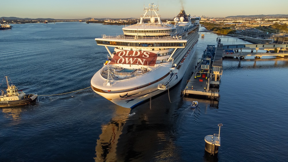
Cruise lines have diverted from Australia Day itineraries in Queensland as Cyclone Kirrily nears landfall.
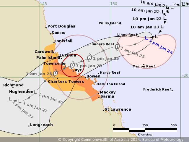
Tropical Cyclone Kirrily is expected to cross the coast near Townsville, between Ingham and Ayr, tonight (Thursday) then weaken over inland Queensland on Friday. Gales are now occurring over Whitsunday Islands, and will extend to the mainland today.
After landfall Kirrily, now a Category 2 system, is forecast to quickly weaken to a tropical low, moving further inland and then west across central Queensland. This would bring heavy to intense rainfall to areas.
Gales with damaging wind gusts to 120kmh are likely to develop about the Whitsunday Islands tonight. It will extend to mainland communities between Ayr and Sarina on Thursday morning.
A spokesperson from Carnival Corporation said several lines had already been affected.
“P&O Cruises Australia’s Pacific Encounter, departing Brisbane tomorrow (Tuesday) will no longer visit Airlie Beach. Instead, the 4-night voyage will call at Tangalooma/Moreton Island on Wednesday.
“Cunard’s Queen Elizabeth, departing Sydney today, was due to visit Queensland on a 10-day cruise. Instead, the ship will steer a course south of Sydney, to remain well clear of the weather system, and return to Sydney as scheduled on 1 February.”
What is the forecast of Cyclone Kirrily?
Forecasts are expecting the low-pressure system to continue moving to the southwest and pick up speed on its way to make landfall along the Queensland coast Thursday night.
At this stage, areas between Cairns and Mackay are at risk of direct impacts, with a possible direct hit for Townsville and/or Ayr. Given its forecast speed, inland areas in the Northern Goldfields and Upper Flinders, like Charters Towers, could also see tropical cyclone strength winds before the system weakens.
As with most severe tropical cyclones, storm surge could become a concern along the coast. It t could lead to coastal inundation and exacerbate any flooding.
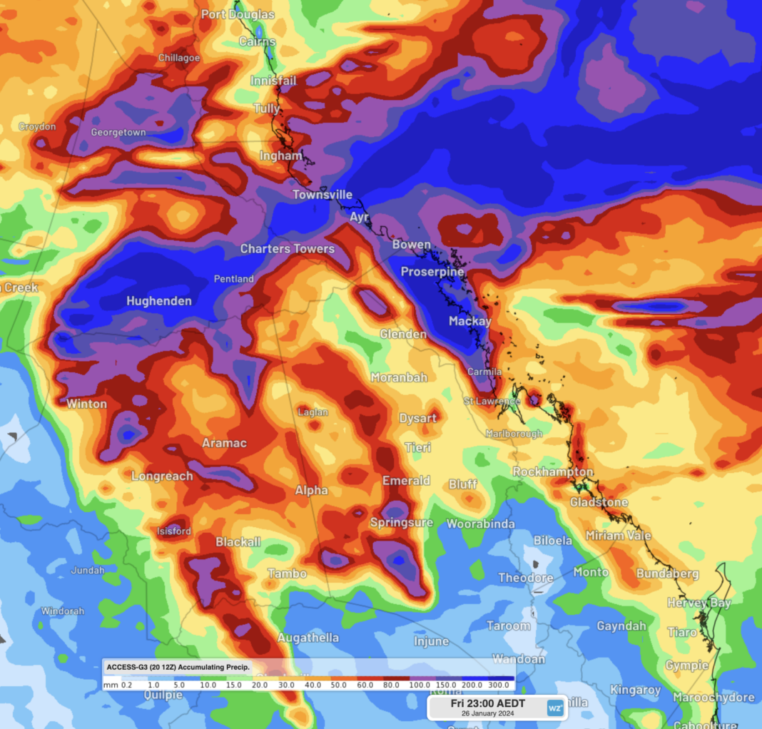
Widespread rainfall of 100-200mm, with isolated falls of over 400mm, is expected over parts of the North Tropical Coast and Tablelands, Herbert and Lower Burdekin, Central Coast and Whitsundays, Northern Goldfields and Upper Flinders, Central West and Central Highlands and Coalfields districts between Wednesday and Friday.
There is also the potential for rainfall as heavy as 250-350mm falling in six hours for some parts. Most likely on the southern flank of the system.
Queenslanders in the path of this tropical cyclone are advised to keep a close eye on the warnings issued by the BoM and the Queensland Government over the coming week, as well as the Weatherzone news feed for further developments.
Last year, Cyclone Jasper also wreaked havoc with several ships having to change course.
Related Posts
-

The Sunshine Coast-based LifeFlight aeromedical crew has winched a man with a cardiac condition off a cruise ship yesterday. The rescue took place about 30 nautical miles north of K'gari,…
-
Carnival Splendor is finished with her dry dock in Singapore and is ready to return to Australian waters with a brand new look.
-
Norwegian Encore will be dry-docking for two-weeks over November and December and will emerge with a range of upgrades and enhancements across the ship.
-
While the seas might be rough, some passengers are still enjoying their cruise.